Inspiration
The most beautiful spots on the GR20
From north to south, the highlights of the traverse: high-altitude lakes, iconic peaks and legendary passages. Plenty to dream about before you set off, and a way to spot what you really shouldn't miss along the way.
How to read this page
From the northern ridges to the southern needles
On the trail
Most of these places lie directly on the GR20: you cross them without any detour, stage after stage.
On a detour
A few peaks (Cinto, Rotondo, Monte d'Oro) or points of interest call for a side trip — flagged as a "detour", for seasoned hikers or spare days.
From north to south
The places follow the classic order from Calenzana to Conca. Each entry links back to the stage concerned.
The highlights
15 places not to miss
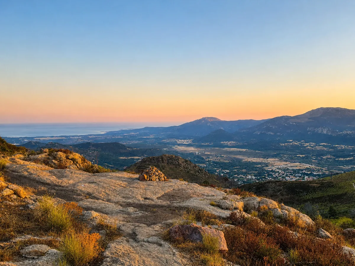
Stage 1 · ~km 5 · ~1,250 m
Ridges above Calenzana
From the very first hours, the trail climbs steeply above Calenzana and tips over onto ridges that suddenly open out over the Fango valley and, far off, the sea. An opening that sets the tone for the GR20.
Good to know: Set off early (leaving Calenzana is forbidden after 11am) to climb in the cool.
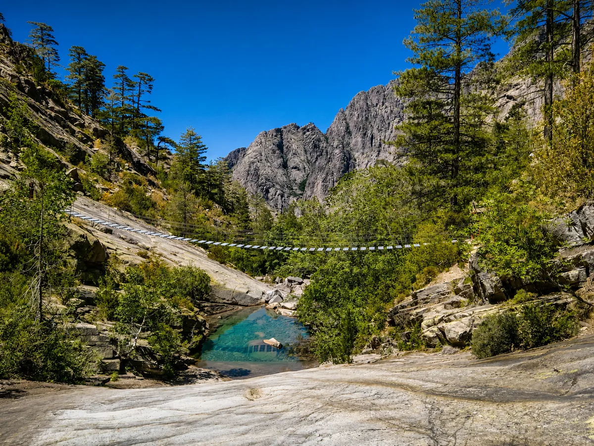
Stage 3 · Carrozzu → Haut-Asco · ~1,500 m
Footbridge & slabs of the Spasimata
A suspension footbridge crosses the Spasimata torrent, then the path traverses great slabs of polished rock fitted with chains above the void. One of the most photographed passages in the north.
Good to know: Very slippery in wet weather: take care on the slabs after rain or early in the morning.
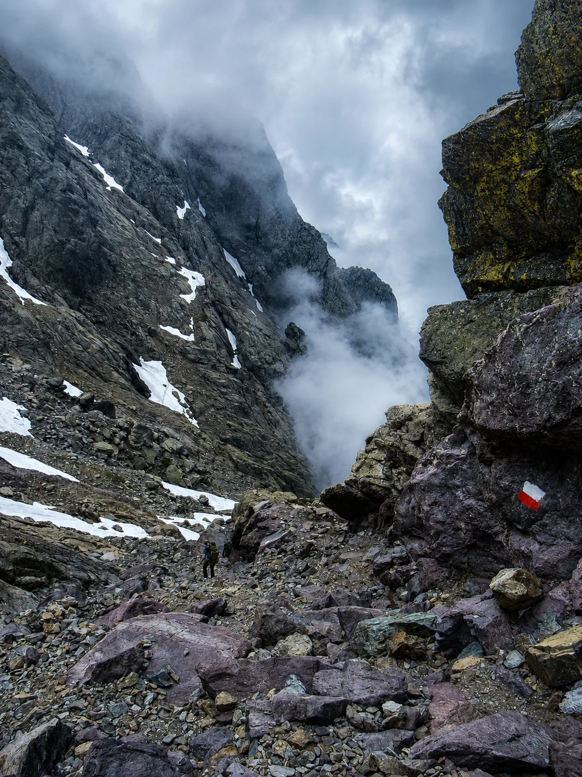
Stage 4 · Haut-Asco → Tighjettu · high point 2,607 m
Cirque de la Solitude & Pointe des Éboulis
Long the most legendary and most demanding passage on the GR20. After the deadly rockfall of June 2015 (7 victims), the cirque was de-waymarked in 2016: the official route now bypasses it via the Pointe des Éboulis (2,607 m), the highest point of the GR20.
Good to know: The cirque itself is no longer crossed on the GR20 (accessible only with a guide). The current variant remains high, rocky and exposed.
Stages 3-4 · Haut-Asco sector · 2,706 m
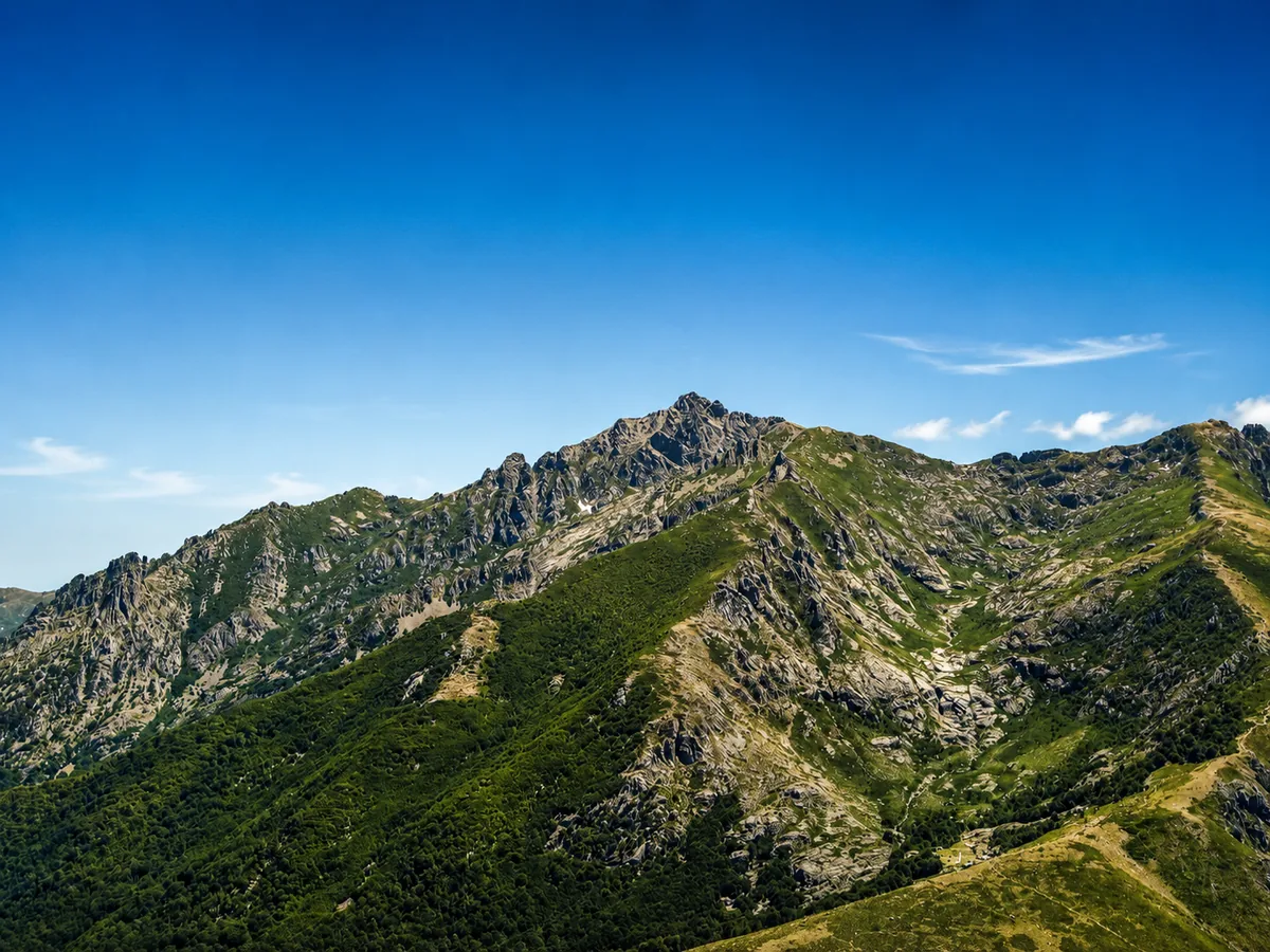
The Monte Cinto massif
The highest peak in Corsica, the Cinto towers over the whole north of the island. The GR20 doesn't climb to its summit but moves at its feet, through a world of scree, ridges and pale rock.
Good to know: The climb to the summit is a demanding detour from Haut-Asco, reserved for seasoned hikers and fine weather.
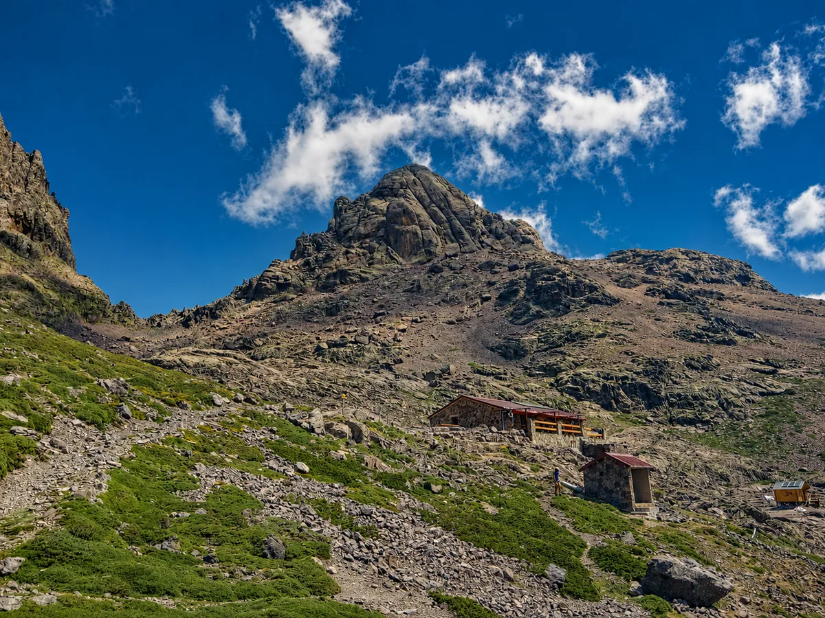
Stage 5 · Ciottulu di i Mori refuge · 2,525 m
Paglia Orba, "the Corsican Matterhorn"
Its pyramidal silhouette is one of the most recognisable in Corsica. The trail passes at its foot, near the Ciottulu di i Mori refuge, facing this wall of granite that shifts colour as the day goes on.
Good to know: Magnificent at sunrise from the Ciottulu area.
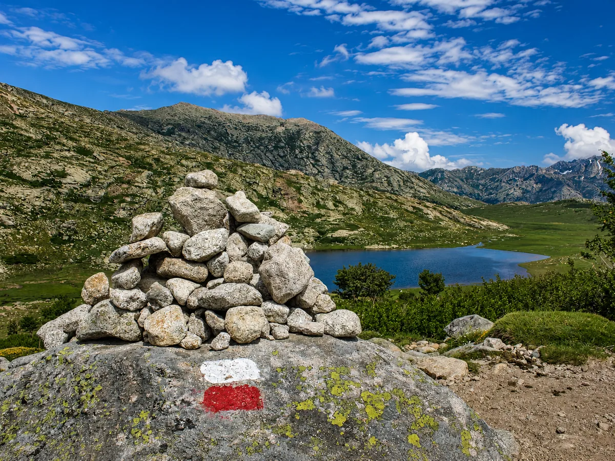
Stage 6 · Castel di Vergio → Petra Piana · 1,743 m
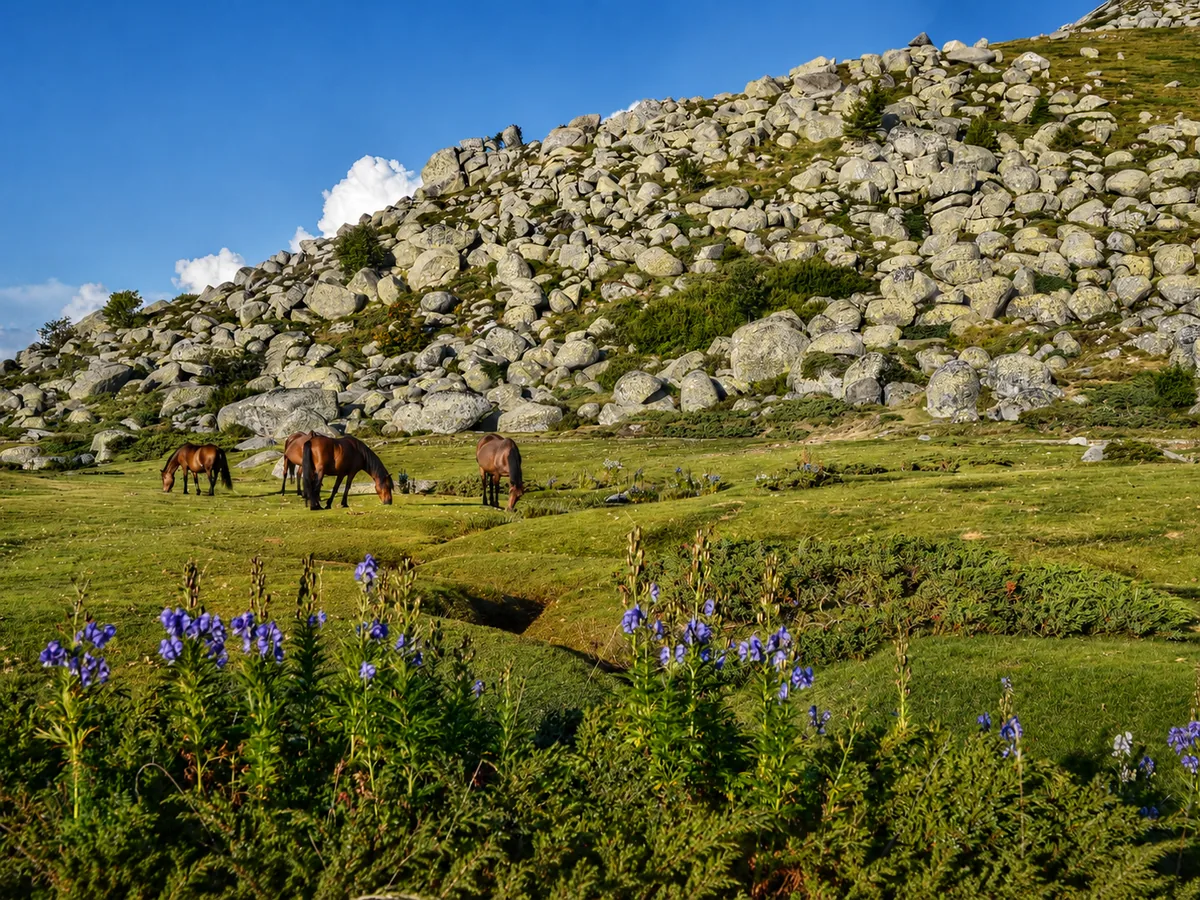
Lac de Nino & pozzines
The postcard image of the GR20: a high-altitude lake set on vast peaty meadows, the pozzines, where horses and cows often graze freely. Superb reflections and light in the calm of morning.
Good to know: An easy and highly recommended detour; the source of the Tavignano, one of Corsica's great rivers.
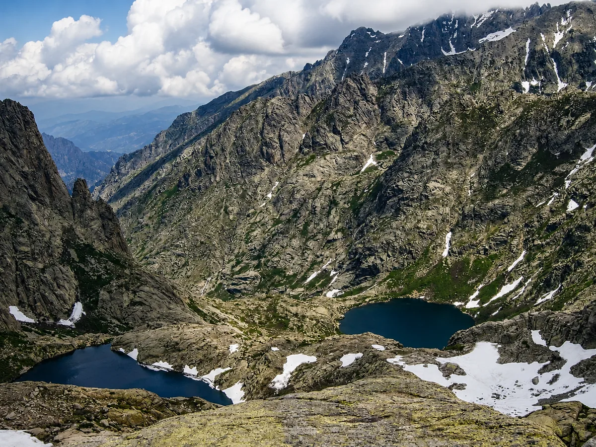
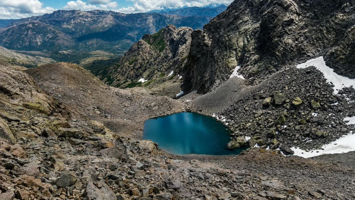
Stage 6 · Manganu → Petra Piana · ~1,900 m
The Melo & Capitello lakes
Two glacial lakes hemmed into a cirque of rock. The Capitello, one of the deepest in Corsica, often stays frozen late into the season. A raw, grandiose setting.
Good to know: The viewpoint from the Capitello notch is worth the stop; windy and cold at altitude, even in summer.
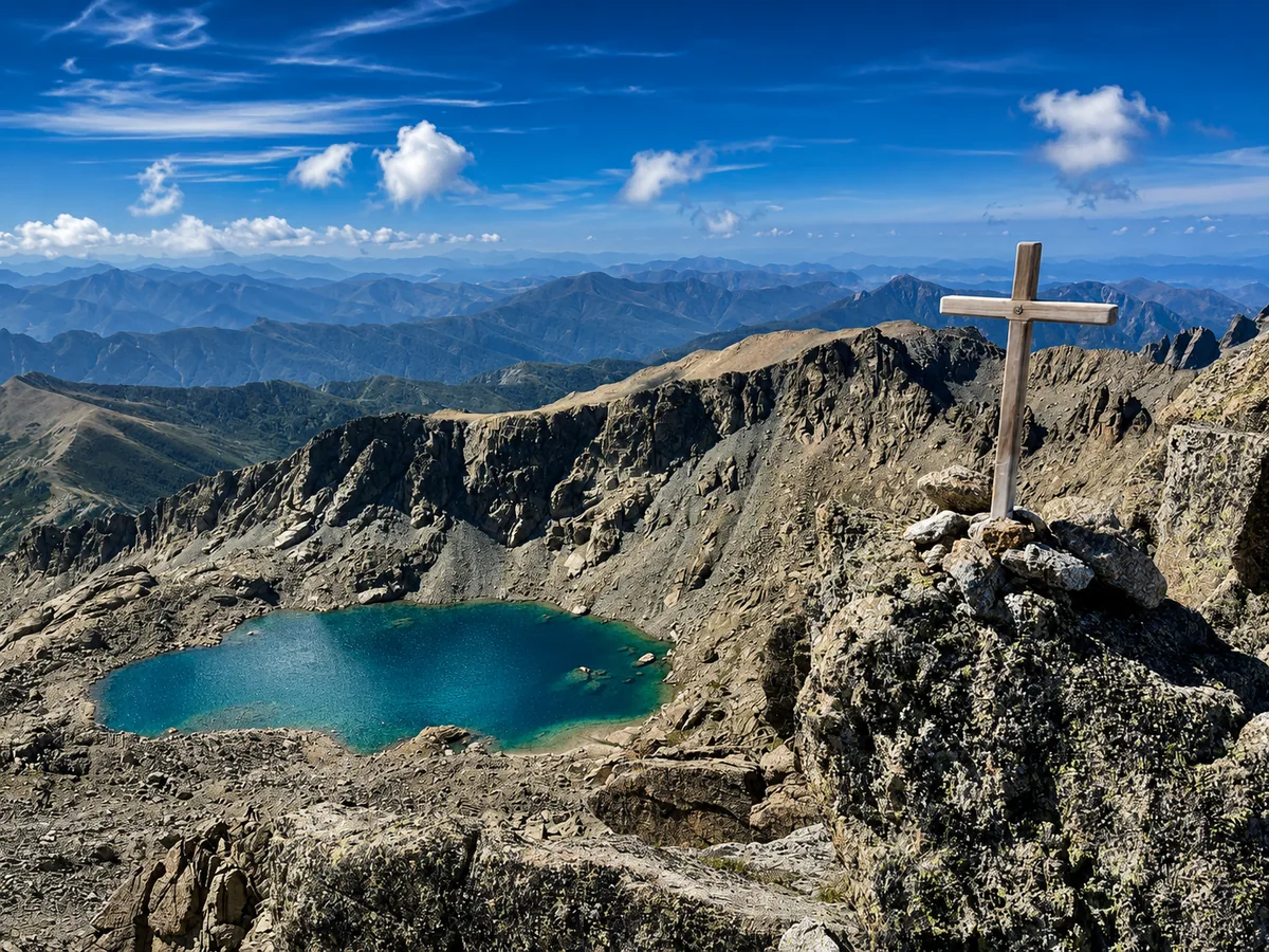
Stage 7 · detour from Petra Piana · 2,622 m
Monte Rotondo (detour)
The second-highest peak on the island, reachable as a detour from Petra Piana. An immense panorama over the lakes, the central ridges and, in clear weather, both seas.
Good to know: A long and physical detour: attempt it only in settled weather, with a very early start.
Stage 7 · Vizzavona · ~900 m
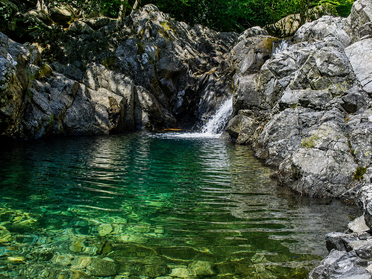
Vizzavona forest & the Cascade des Anglais
The hinge between north and south, Vizzavona unfurls a superb forest of laricio pines and beeches. A stone's throw away, the Cascade des Anglais and its pools make for a popular cool-down stop.
Good to know: Train station, resupply and a possible bail-out point: the ideal place to split the traverse in two.
Stage 8 · detour from Vizzavona · 2,389 m
Monte d'Oro (detour)
A massive pyramid overlooking Vizzavona, the Monte d'Oro is a classic detour for peak-baggers, with a plunging view over the forest and the whole centre of the island.
Good to know: A technical and long detour; allow a full day and experience on steep terrain.
Stage 10 · southern sector · ~1,600 m
The Coscione plateau
After the northern ridges, the south opens onto vast plateaus of grass and pozzines, gentler and more pastoral. A restful contrast, dotted with shepherds' huts, before the Aiguilles de Bavella.
Good to know: Rolling, more welcoming terrain: a section often appreciated as a chance to catch your breath.
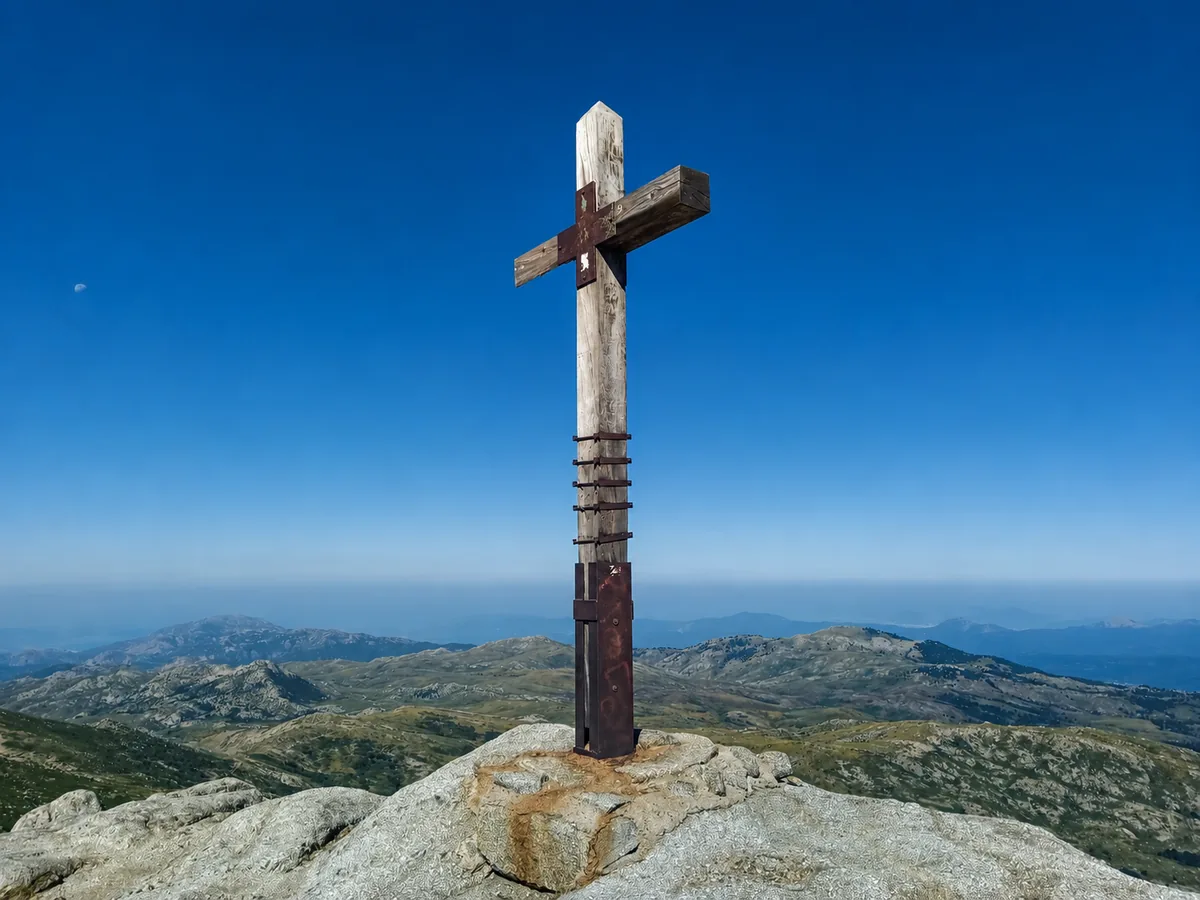
Stage 11 · Asinau sector · 2,134 m
Monte Incudine (Alcudina)
The highest peak in southern Corsica, the Incudine offers a broad summit plateau and a view that reaches as far as the Tyrrhenian Sea. The last great viewpoint before Bavella.
Good to know: Very exposed to afternoon storms: best crossed in the morning.
Stage 11 · Foce di Bavedda · ~1,600 m
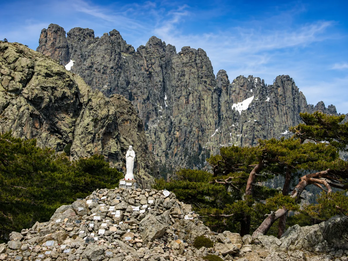
The Aiguilles de Bavella
The highlight of the south: a wall of red and ochre granite needles cut out against the sky. One of the most spectacular landscapes of the entire traverse.
Good to know: Sublime light at the end of the day; an alpine variant, more technical, doubles the classic route.
Detour · Col de Bavella · ~1,300 m
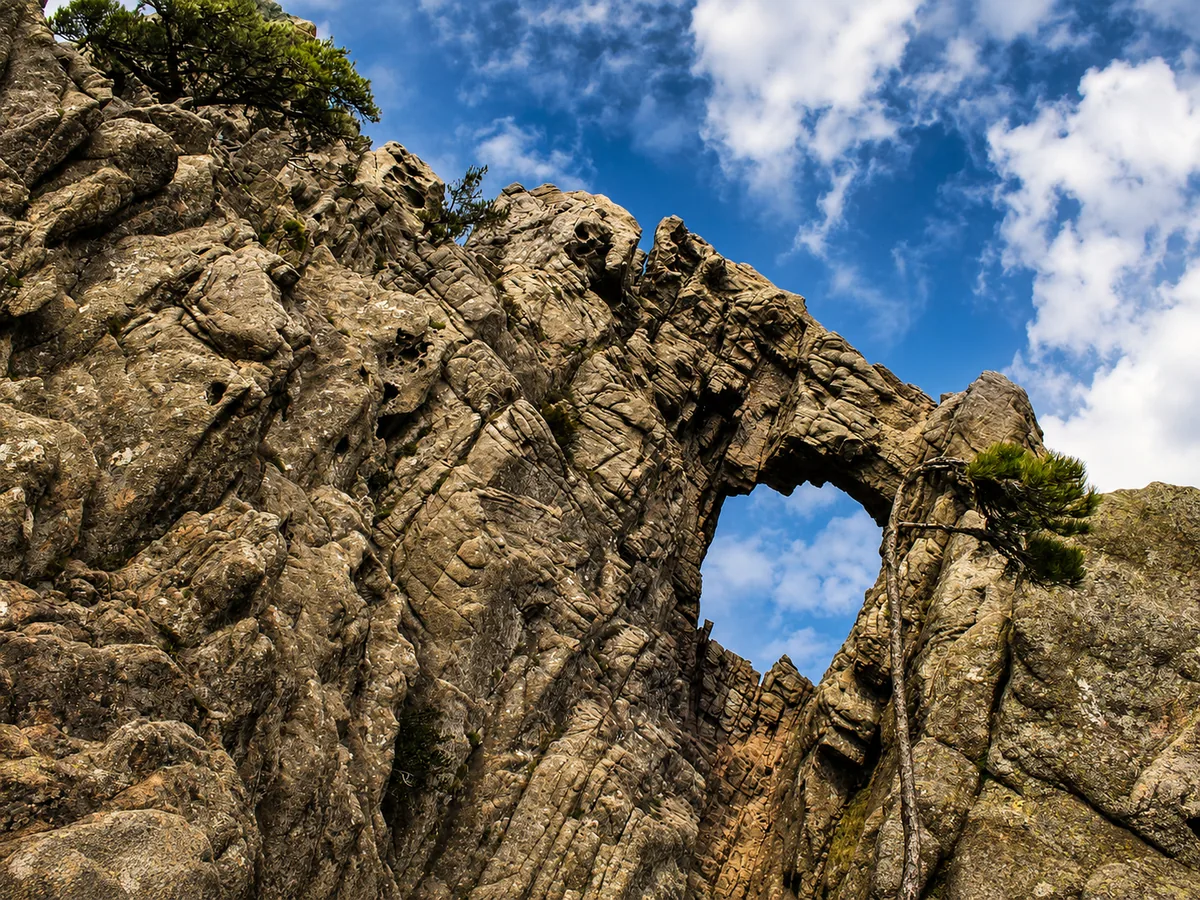
Trou de la Bombe (detour)
A natural arch pierced through the rock, reachable on a short detour from the Col de Bavella. A geological curiosity and a fine viewpoint over the needles.
Good to know: A fairly short, family-friendly walk from Bavella, off the GR20 route.
Stage 12 · descent towards Conca · finish
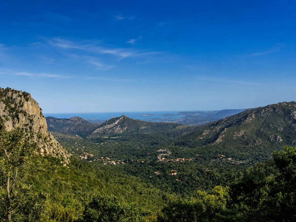
The final descent towards Conca
The last kilometres plunge into the maquis and the glowing red rocks towards Conca, the sea straight ahead. A gentle, luminous finish after more than 200 km of adventure.
Good to know: Savour it: this is the end. Shuttles are available from Conca to Sainte-Lucie and Porto-Vecchio.
Video
The feel of the trail, in vertical
A vertical format to recapture the rhythm of the GR20: the ridges, the breaks, the fatigue and the energy that returns stage after stage.
Take action
Build your itinerary around these places
Want to plan your traverse to make the most of these highlights? The planner splits the GR20 into balanced days to suit your pace, with a map, elevation profile and booking points.
Read also